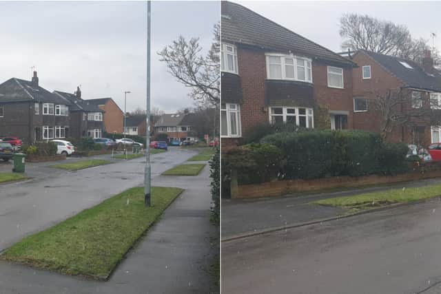
Snow flurries fall in Cookridge in Leeds as freezing conditions blast Yorkshire
and live on Freeview channel 276
Heavy snow has fallen in parts of Yorkshire, though, as freezing blasts make their way across the county.
Forecasters predicted ice, frost and snow to make conditions treacherous this weekend and the meteorological gods have thus far served up heavy snow in Halifax, some brief flurries in Leeds and a whole load of ice to contend with.
Advertisement
Hide AdAdvertisement
Hide AdIn Cookridge - the unofficial snow capital of Leeds - some brief flurries of flakes have been spotted falling on Saturday morning.
In Halifax, buses have been diverted due to heavy snow.
Elsewhere, drivers have woken up to ice-covered cars and in general, heavy frosts and black ice are making conditions more difficult than usual, albeit exactly what we'd expect in the middle of winter.
What is the forecast for Saturday?
Today:

After a cold and frosty start many areas will have a dry, sunny but cold day. However, cloudier conditions will persist across the Pennines, with scattered wintry showers here. This evening temperatures will quickly fall. Maximum temperature 3 °C.
Tonight:
Isolated wintry showers may continue across the Pennines, but most places will be dry with clear periods, with possibly some patchy freezing fog forming. A widespread sharp frost will develop. Minimum temperature -6 °C.
Sunday:
Advertisement
Hide AdAdvertisement
Hide AdAfter a very frosty start it will remain cold with temperatures hardly climbing above freezing, despite sunny spells and light winds, once any early patchy freezing fog slowly clears. Maximum temperature 3 °C.
Outlook for Monday to Wednesday:
Frosty start then cold with sunny spells, and mainly dry, for Monday. Widespread overnight frost. Tuesday mainly dry and bright, then snow overnight. Wednesday any residual snow easing, becoming milder.